May 5: Day 8, Arroyo Frio-Alcaraz
I have some minor gripes with this hotel: for instance, their Wifi blocks whereishugh.com, I had to use a VPN. And their soap turns sandy after a day.
But the breakfasts are so awesome I'm going to forgive them: there are waffles, pancakes, bacon, fruit, cornflakes, yoghurt, and various flavours of chocolate sauce, berry sauce, and there was maple syrup in there too. Plus some pastries that go crunch when you bite them. Better than Cordoba, and roughly half the price.
From left to right: my breakfast, part 1 of about 5. Doughnut selection. All the good stuff! All the drinks I'm taking today. And the bike at leaving time; the drinks bag is definitely getting top heavy.
Anyway. I got on the road about 8:45. I'd checked the road on the map earlier, it closely followed the river down the valley, and was hoping for a smooth downhill run - unfortunately not, there were many climbs. Nothing that needed the lowest gear though.
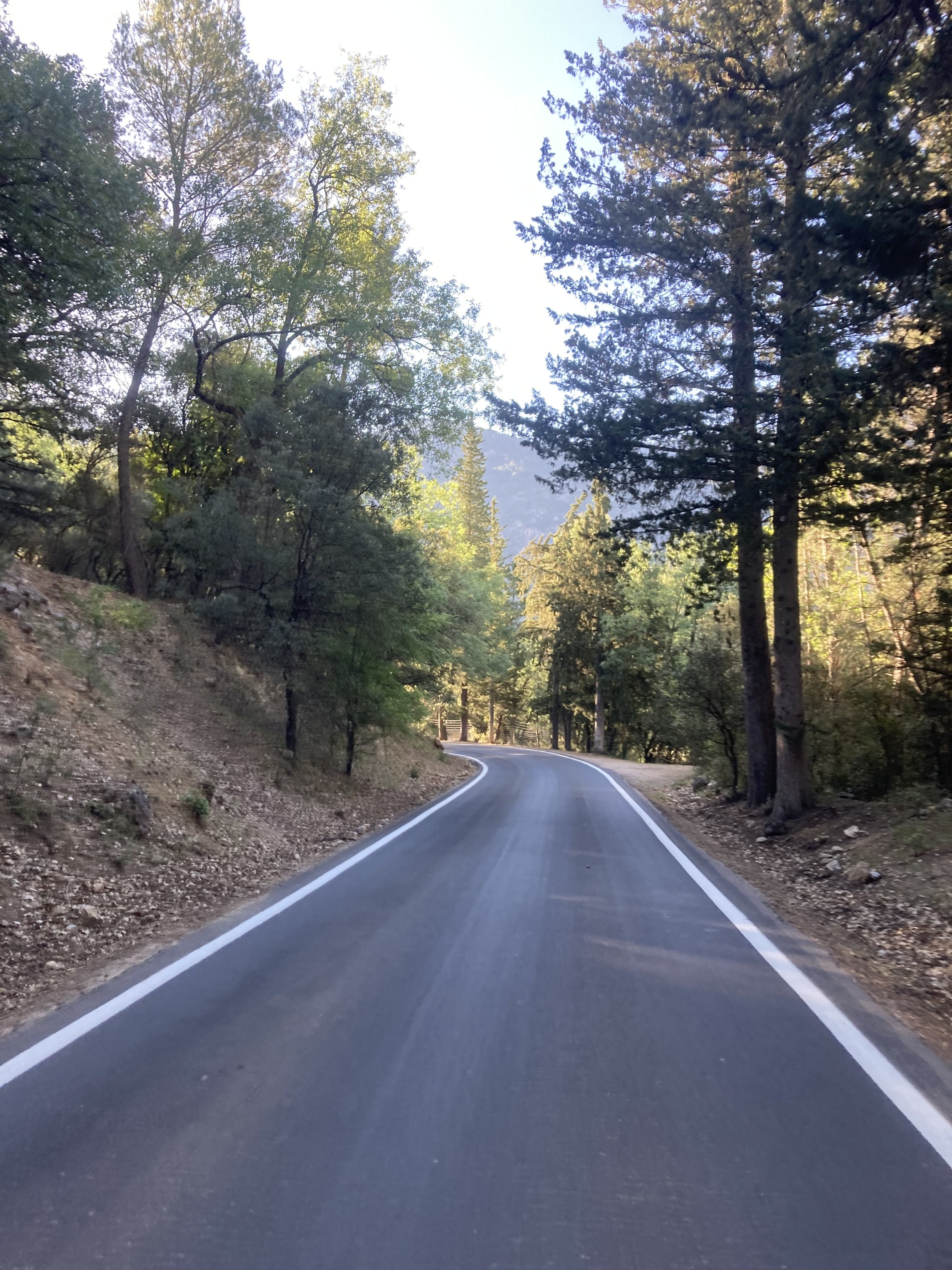
Since it was at the bottom of the valley, it was all in shade and it was nicely chilled. The road was surrounded by tall trees, so even when the sun was higher there was little direct sunlight, so it didn't get too hot.
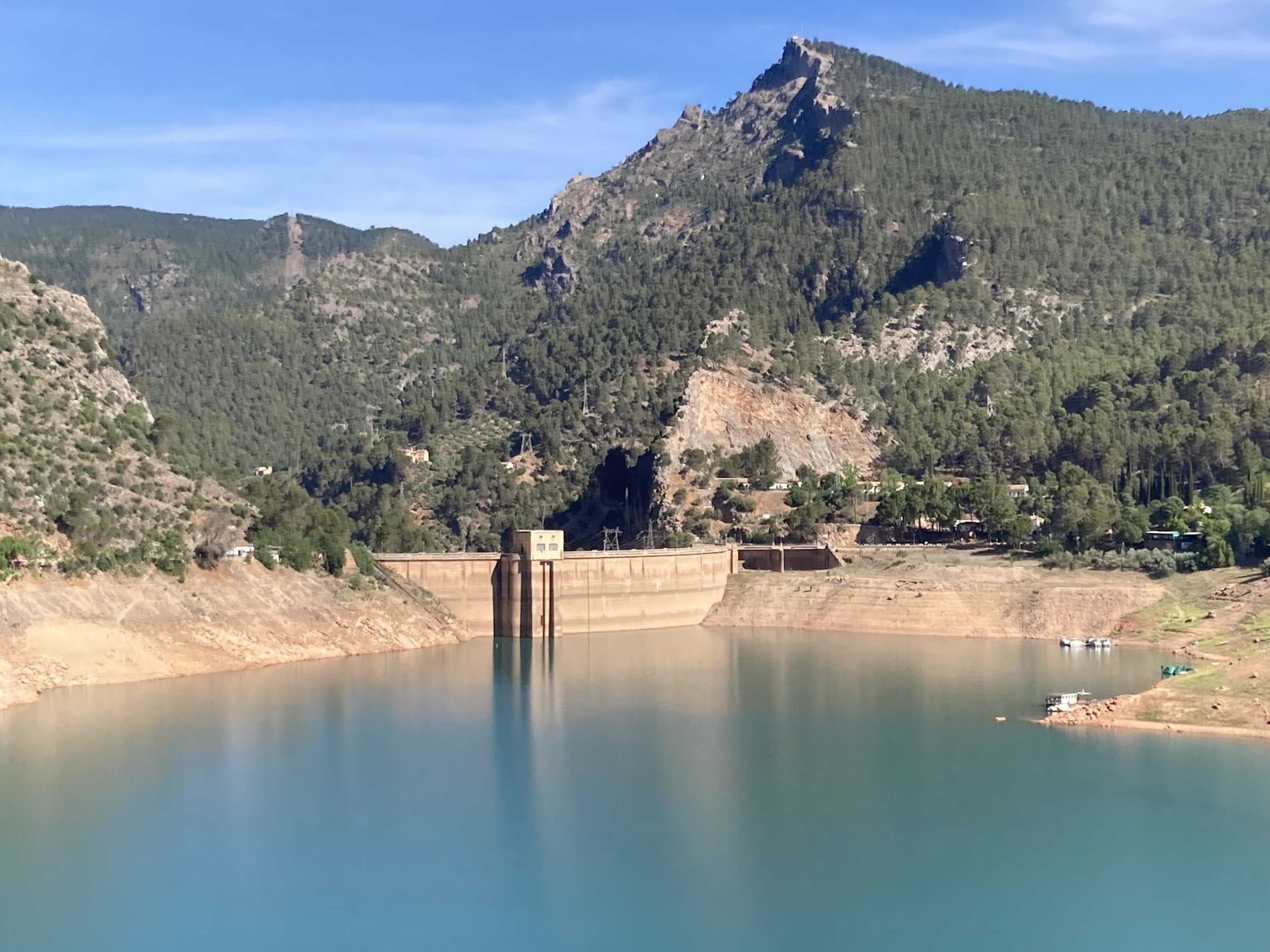
The route followed the west side of a lake and I was looking forward to being near the water: no again, it followed a contour high above. But with some very nice views! And I saw deer cross the road in front of me two or three times; too quickly for a photo though.
It was shaded and cool through all of this part, making this a very nice ride.
From left to right: Leaving Arryo Frio. In shade, so it stayed cool. A bit further down, no longer shaded but the trees help a lot. The lake, you can clearly see the water level is low. Reflections. More reflections. A less zoomed view.
The low water level can't be good, since this is late spring and summer is near.
After following the road around the lake a bit further, the dam wall came in view; the spillway was far above the current water level. Hopefully it's not as bad as it seems.
From left to right: a view of the dam wall, the spillway is on the right. Back of the dam wall.
After a bit the route diverged from the nice, smooth asphalt road and went up a rough backroad.
From left to right: the route leaves the good road. A random house; figured I shouldn’t just take pictures of the pretty stuff. The route got rougher. And rougher.
Around here the two wheel tracks that I'd been following entered a stand of those stumpy trees and disappeared. I'm very, very grateful for GPS and online maps, because it made it easy to get back to it: it was a steep slope with loose gravel and getting the bike uphill was difficult, so I was very glad I didn't have to search.
From left to right: the gate. The catch; I’ve gone through much worse in NZ. This means: keep the gate closed, there are loose cattle.
After that it was relatively plain sailing: the route was overgrown but very passable, and no risk of losing it. It came to a wire mesh gate, which very effectively closed off the whole path - but it was closed by a wire hook, not a padlock or anything so it was no problem to get through. (Well, trying to handle a sagging mesh gate one-handed while pushing the bike without dropping either wasn't a walk in the park.) Once through I there was a sign saying "keep the gate closed, there are loose cattle" so I guess the route was permitted, even if it felt a bit dubious.
Then it finally went downhill, and I ended up in a small town called Cortijos Nuevos for lunch.
After lunch: more hills, more Spanish towns, more near-30C temperatures.
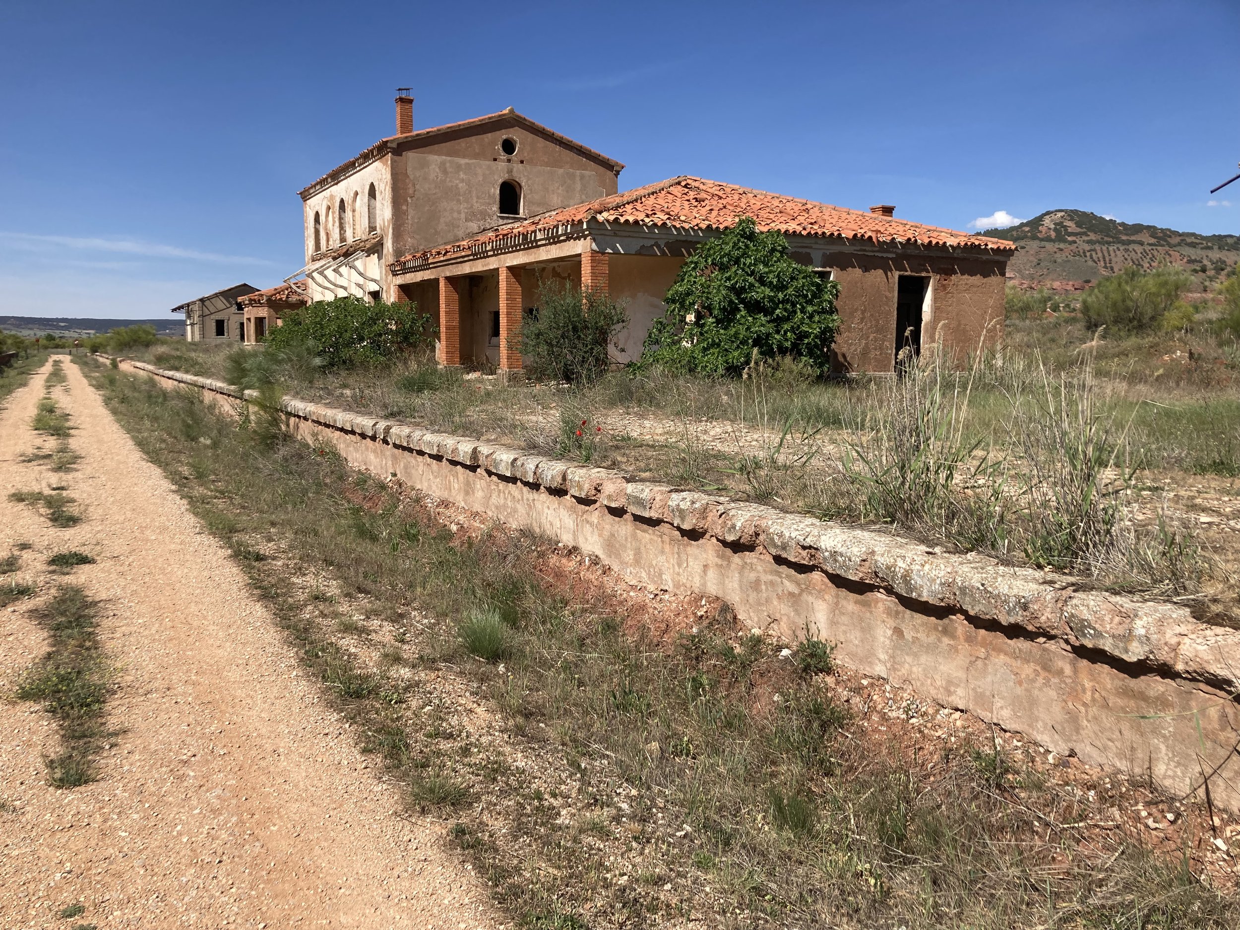
But then there was the rail trail - ie, a cycle path built on an old railway line. These are my new favourite thing.
From left to right: the abandoned station at the start of the trail. As it’s an old railway line, it’s straighter and flatter than other parts of the route. And there are tunnels! Another abandoned station. A less presentable section, but it’s so straight.
From left to right: at the end was a 520m tunnel. In the middle it was pitch black; I needed to use torch mode on the phone to see enough to keep cycling. The final station. End of the line.
It was only a few kilometers after that to Alcaraz, which is another village built on a steep little hill. I’d got the hostel address from Google Maps, and it led me to a road below the place, with no way in. I had to loop around and go up a rather steep street to get to the entrance. Inside it was all dark, with no-one at reception; no bell, and the phone number in the confirmation email wasn’t valid. It all got sorted in the end though!
At the top of the hill is a bullring, somewhat larger than a village this small would need, which says a lot about how popular it must have been back when it was built. It’s not crumbling or neglected either, it’s in remarkably good repair, suggesting it still is regularly used - maybe not for bullfights, perhaps. Unfortunately it was completely locked up and I couldn’t see inside.
After dinner I was making my way back to my room and heard a brass band practicing. I was trying to get a decent view of the sunset, which was coming from the same direction, so I followed the sound - it was coming from the bullring building. I guess if bullfights are out of fashion, you need to diversify…
What I’m listening to: Happiness Does Not Wait, Ólafur Arnalds: https://www.youtube.com/watch?v=pg7TY7vLAgg
Chill ambient piano music, for a relatively chilled day.


