November 22, Day 37: Los Angeles to Concepción
I’m taking a fairly direct path from Los Angeles to Concepción, and the main roads don’t go that way. So today’s route goes through some deeply rural back roads.
One thing I didn’t grasp before starting is that while there’s 1000m of climbs, which is average, it’s almost all in the second half. So the first few hours were a straightforward run on asphalt. And then the backroads are only climbs, all gravel, low gear the whole time. The elevation profile shows four big climbs: they’re 100-150m each, which won’t be too bad if the gravel isn’t too deep.
The route out of Los Angeles wasn’t great. The road shoulder was too small to be any use so I used any space on the side that I could. Traffic was fairly light fortunately.


From left to right: there were distance markers painted on the roadside today. The number is kilometers, the dots increased every 20m.
In a happy exception, it went through a cloverleaf junction to cross the Ruta 5, and there was decent cyclist space the whole way! Not a cycle lane, but a road shoulder big enough for cyclists. That’s a nice change; normally these junctions have no cycle space and crossing them is a high-stress, high-stakes situation.
But afterwards there was no shoulder at all: past the white line, the asphalt ended. This was a two-inch drop. Next to that is a steep grass bank. So going a little wide will instantly escalate things to trip-ending proportions ... I carefully stay on the white line.
Two hours after starting the route takes a hard left onto gravel, leaving the asphalt behind. It's going to a village called Rio Claro, which can be accessed by asphalt roads but it'd about three times longer if I were to take them: there's a clear flow to the main roads, and I'm cutting across them.
Rio Claro is where the first of the day's four big climbs starts. It's about 150m, nothing too steep, the only complication is that there's lot of dogs and they all bark at cyclists. None were free, but I suppose I wasn't going fast enough to be worth chasing anyway. I didn't see much of Rio Claro, and I suspect there wasn’t much to see.
Rere is the next town and the route there is still all gravel. Rere is a larger and bit more interesting, there's a church tower and the houses have a bit more character. It’s asphalt in town but the moment the houses stop the road switches immediately to rough gravel and a very steep climb.
It's climb number two, and it was a challenge. Looking at the elevation profile now, I see the first part has a 12% gradient, which explains the difficulty! I cycled partway up and then pushed the bike, but the road was sandy soil so the bike always wanted to slip sideways. It was so steep and the surface so bad my feet were slipping too, which is extra exciting when pushing a heavy bike.

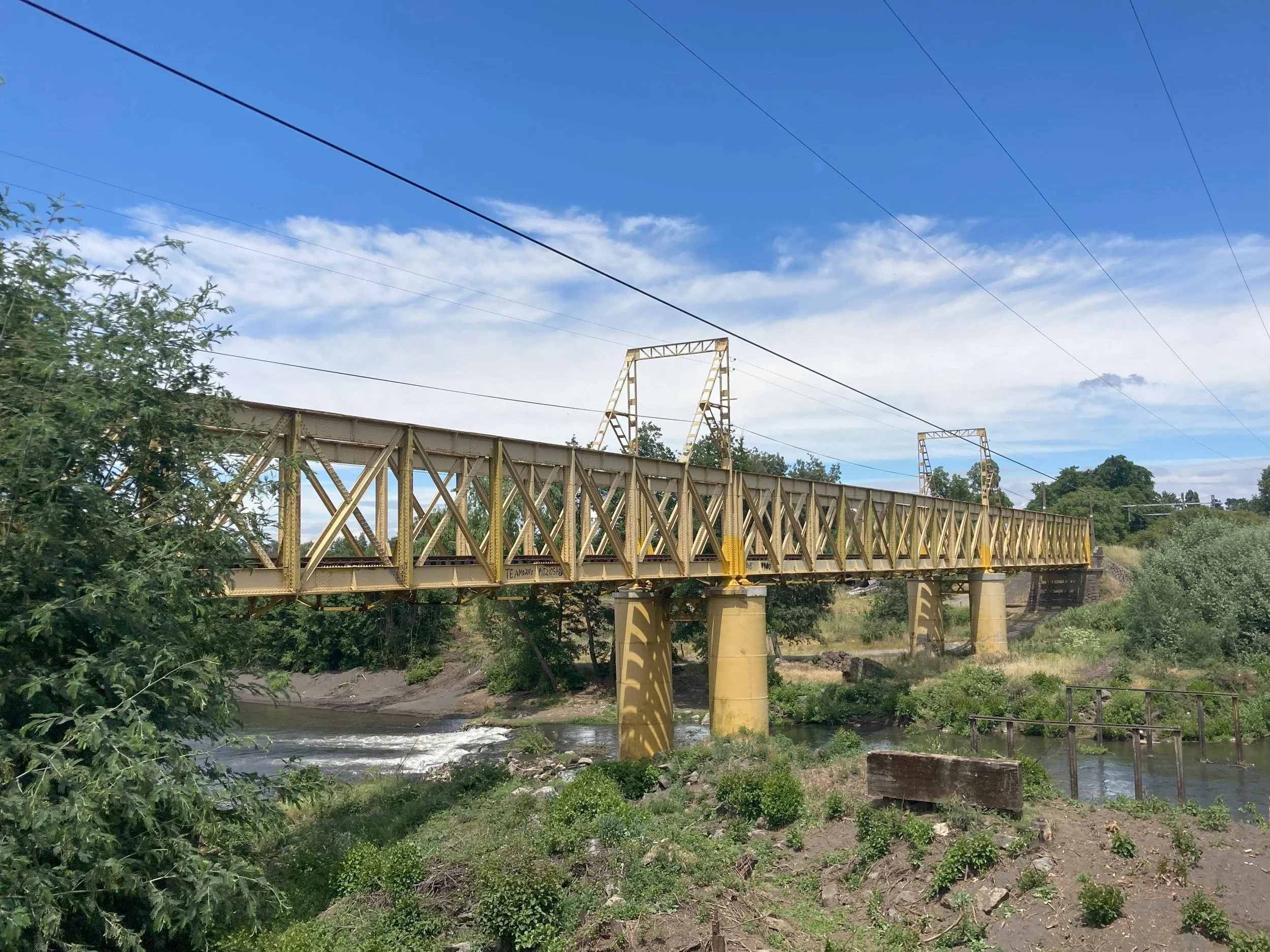


From left to right: being philosphical about being on gravel. Unusually colored railway bridge. Lunch break. Vista after one of the climbs. Approaching Rere. The church tower - which turned out to just be a tower, no church was attached.
It's been gravel with very few exceptions for the last 30km, and I'm deep in the woods. The road crosses a river: on the other side is a work crew putting up what looks like a shop but is presumably a refuge. One of the guys comes over for a chat in my bad Spanish; he invites me to wash in the river. No time unfortunately, and also the vibe is a bit weird. So I press on ... to climb number 3.
This is 100m up on gravel but the climb doesn't get too bad, the elevation profile says 8% is the steepest. I'm leaning forward as much as I can but the front wheel still comes off the ground when I push the pedal down. Which makes it difficult to keep going straight.
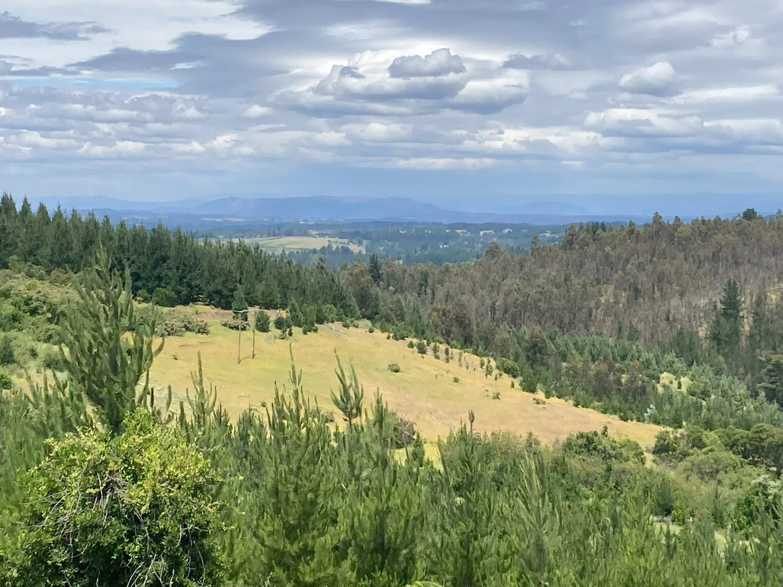
One thing I should mention is that even away from the climbs, the backroads weren't level. They're always going up or down, and it feels like all the uphills are steep. I'm not joking about staying in low gear, on the climbs I couldn't use anything else. On the downhills I'm extra-cautious. After falling over in Temuco, I'm carefully choosing my lines to stay on solid earth where possible, and avoid deeper gravel always. So low gear then too, sadly.
Climb four is 150m, and starts when the road changes from gravel to asphalt. (Finally! I've been on gravel for over four hours.) The asphalt starts at a bridge crossing a river, which means it's at the bottom of a big dip, and there's a climb on the far side. This one's hairy.
I try cycling up the climb but even standing on the pedals in the lowest gear I'm only just able to make progress, I have to get off and push. (The elevation profile says it was a 12% climb, which is quite a lot, even around here.) There's trees everywhere around the road so it's cool and shady and it's as good as pushing a fully loaded bike up a 12% climb can be.
On the plus side, that was the last of the gravel. I'm much happier on asphalt: much smaller risk of skidding and falling, and better traction for climbing.


From left to right: 12% gradient on sandy soil; memorable enough for a photo. The gravel ends and asphalt begins, also memorable - there’s a 12% slope hiding on the far side. Midway up the climb there’s a junction. This is the Hualqui fort, which was the center of the excitement. Komoot thought there was a bikepath for the final 20km, this is a bit of a stretch.
The reason the roads are better is because we're approaching Hualqui! This town most of the reason I came this way. For two glorious days in 1823 it was The Independent Republic of Hualqui, until a battalion from Concepción showed up and the party was over. Never forget, etc. The local sports club calls itself the "Club Deportivo República Independiente de Hualqui", and there's a couple of other outfits with the faint but provocative scent of light treason.
The details are where it gets interesting. 1823 was during the Chilean war of independence, which had turned into a nasty war of attrition. Hualqui was near the front which meant it regularly got wrecked by the Spanish forces. The town appealed for help, didn't get any ... more appeals, no help. So they declared independence and a battalion was promptly sent over to put it down. Which apparently was the town's goal all along: to get some military into the town to help defend against the Spanish raids.
(And while that's a great story I still have questions. Secession is a big call: it's going to get the army sent in, but they're going to be baying for blood and will have orders to Send a Message so all the other towns know declaring independence is a bad idea. "lol jk" won't save you. Did the mayor take one for the team? Was there a carefully planned cover story about how it's all Señor Bob's idea, he ran off to join the Spanish yesterday, and he really, totally exists? Or did they just manage to talk the battalion commander down? I can't find an online source with answers...)
After Hualqui there were some dubious cyclepaths and a route mixup involving a motorway but they're not so interesting in comparison. I'm now in Concepción for two days. I'm down to the last few days now, the ride to Santiago starts on Monday.